
Top 7 Hikes In Black Canyon Of The Gunnison National Park

Planning a trip to Black Canyon of the Gunnison National Park and wondering which hikes to do?
Since this is one of the deepest, steepest, and most narrow canyons in the United States, accessing the canyon floor is extremely difficult without rock climbing, so most hikes stick to the rim.
Along the rim, there’s quite a few trail options, some follow the canyon and others wind through the surrounding pinyon and juniper forests, providing a good chance to spot wildlife and, if the season is right, wildflowers.
These are some of the best Black Canyon of the Gunnison National Park hikes.
Best Black Canyon Of The Gunnison National Park Hikes
Rim Rock Trail
1.7 miles | 206 foot elevation gain | rated moderate | south rim
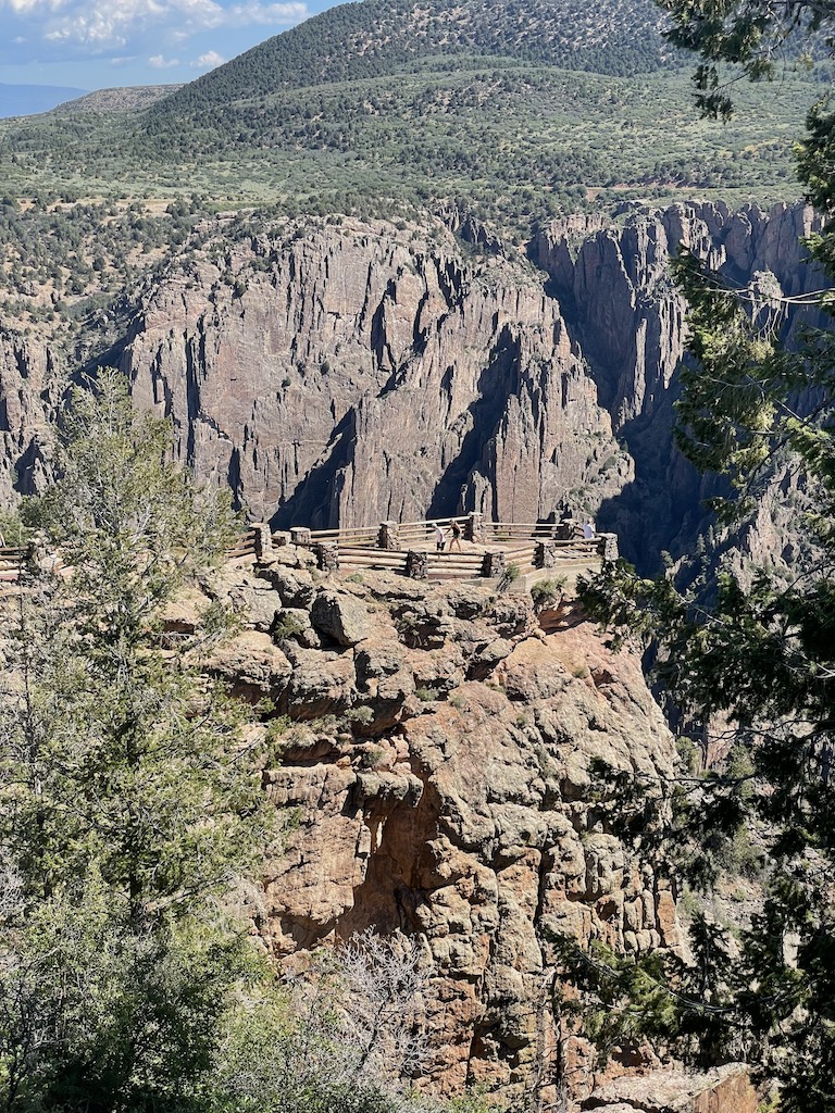
Rim Rock follows the canyon edge for almost its entirety. It has gentle inclines with some rocky sections, which contributes to the moderately difficult rating. The popular trail is well-maintained and provides plenty of places to stop and enjoy the excellent views of the canyon and the Gunnison River below.
There’s little shade on this trail, so it’s best to hike early or be prepared with plenty of water.
This trail starts at the South Rim Visitor Center.
Tip: This trail connects the South Rim Campground with the South Rim Visitor Center, great for those camping in the park.
Oak Flat Loop Trail
1.4 miles | 334 foot elevation gain | rated moderate | south rim
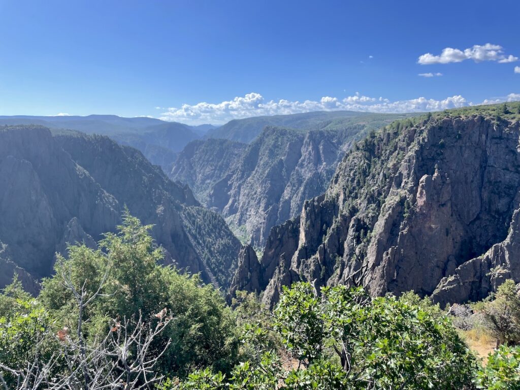
Oak Flat Loop Trail more views of the canyon’s sheer cliffs and the Gunnison River far below. While it doesn’t take hikers to the bottom of the canyon, the trail drops enough below the rim to provide a different perspective of Black Canyon’s depth and steep rock walls.
This trail has a moderately difficult rating thanks to sections which are steep and rocky. Follow the trail clockwise for a gradual downward descent and steep ascent.
Oak Flat Loop starts at the South Rim Visitor Center, near Gunnison Point Overlook, and is one of the park’s most popular hikes.
Uplands Trail
1.5 miles | 423 foot elevation gain | rated easy | south rim
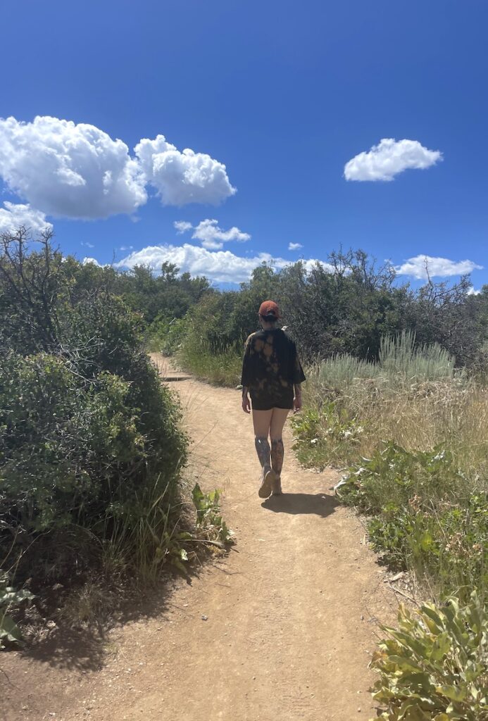
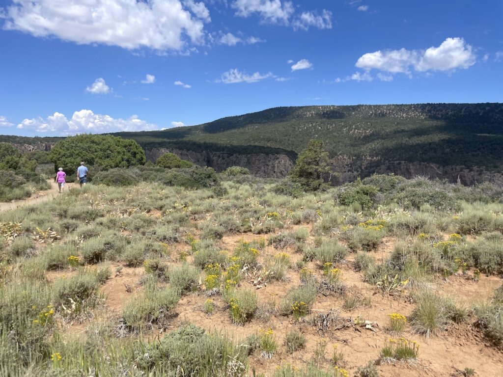
High desert landscape, pinyon-juniper woodlands, sagebrush meadows, wildflowers, and the occasional canyon glimpse is what you’ll find on Uplands Trail.
Wildlife sightings are also common on here, in the early morning and late evening it’s likely to see small animals like rabbits or deer. And, as with much of the Black Canyon, the birdwatching is excellent throughout the day.
Uplands Trail is mostly flat and rated easy, since it’s one of the park’s lesser-used trails it may be overgrown in areas. Last, there’s little shade so be prepared for heat.
Uplands Trail also starts at the South Rim Visitor Center and can be combined with Rim Rock Trail or Oak Flat Loop Trail.
Warner Point Trail
1.5 miles | 423 foot elevation gain | rated moderate | south rim
Warner Point is a popular trail on the park’s south rim, providing a view into a wider portion of the canyon, which allows hikers to really take in the jagged rocks towering up above the Gunnison River. Sweeping views of Montrose, Delta, and the Grand Mesa are also visible in the distance.
Along the trail are nature signs with information about the park’s plants and geology, plus occasional benches in shaded areas.
The 1.5 mile hike is short but has a 423 foot elevation change, resulting in a few steep sections and a moderate rating.
Warner Point Trailhead is located at the far end of South Rim Road.
Hike Into The Canyon: Gunnison Route
1.7 miles | 1,771 foot elevation gain | rated hard (Class 3-4 scramble) | south rim
There are no official trails into the canyon, but there are a few wilderness routes accessible to those with a permit. Gunnison Route is the most popular by a long shot.
The route is only about 2 miles, but covers nearly 1,800 feet of elevation change in that very short distance. Ascending and descending the steep and loose terrain is for advanced hikers only.
This route does have chains to help with the climb, it’s recommended to bring gloves for these, and bring hiking poles for the sections without chains.
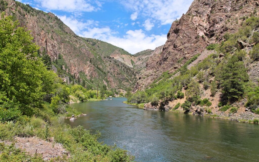
Once at the bottom, hikers can access the river and will have excellent views of the surrounding canyon walls.
Again, permits are required. There are only 15 permits granted per day which can be obtained at the visitor center the afternoon before or morning of.
Exclamation Point
2.9 miles | 364 foot elevation gain | rated easy | north rim
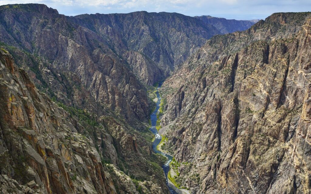
The north rim’s Exclamation Point is one of the best overlooks in the park, offering a straight on view of the Gunnison River flowing directly between the canyon walls 1,800 feet below. There’s also a lovely view of the beautiful Painted Wall here.
The 2.9 mile hike is rated easy with 364 feet of elevation change, making it a great hike for all skill levels. There are some shaded areas on the hike, but be prepared for sun exposure.
Exclamation Point is located on the park’s more remote north rim (2 hours from the south rim), with the trailhead beginning near the North Rim Ranger Station.
Green Mountain Summit via North Vista Trail
6.8 miles | 1,280 foot elevation gain | rated moderate | north rim
Green Mountain Summit begins at the same trail as above, passing by Exclamation Point and several other overlooks. Following the viewpoints, hikers will gradually work their way up the mountain through pinyon and juniper trees.
From the summit, hikers have a view the canyon as well as surrounding valleys and the distant San Juan Mountains.
This 6.8 mile hike has a 1,280 foot elevation change and is rated moderate.
Tips For Hiking In Black Canyon Of The Gunnison National Park
Below are a few tips for hiking in Black Canyon of the Gunnison National Park:
- This park is quite warm in summer and the sun is very intense at this altitude, it’s important to dress appropriately and bring plenty of water.
- Afternoon thunderstorms are common in summer and can be dangerous. Exact weather will vary throughout the park; the canyon floor, north canyon rim, and south canyon rim can all simultaneously experience different weather. It’s best to call the visitor center if you have weather-related questions pertaining to your visit.
- I recommend downloading the AllTrails app. Here you can find trail reviews which provide helpful information and up-to-date conditions for popular trails. Additionally, users can download live trail maps which can be accessed without cell service (this is my favorite feature).
- Park rangers will also be very helpful for those with questions regarding trail conditions.
- Some of these trails have steep drop-offs, usually at overlooks, be cautious especially with children.
What To Pack For Hiking
Most visitors don’t need anything special for hiking in Black Canyon of the Gunnison National Park, breathable athletic wear or basic hiking gear will do.
Remember, summer here can be quite hot, so you’ll want light, breathable pieces and sun protection such as hat, sunscreen, and sunglasses.
Even in summer, mornings and evenings will be chilly compared to midday. Pack layers which are easy to take on and off, and always carry a light rain jacket or wind breaker in case an afternoon storm hits.
There isn’t anywhere in the park to get food, so pack lunch and snacks. And again, it’s important to bring plenty of water.
Below are items I pack when hiking Black Canyon of the Gunnison National Park in summer or early fall:
- Shorts or lightweight pants
- Tank top
- Light weight long sleeve shirt or fleece
- Rain jacket or windbreaker
- Hiking boots or sneakers with good traction
- Wool socks
- Hat
- Sunglasses
- Sunscreen
- Reusable water bottle
- Snacks/ lunch
- Hiking poles
- Backpack
- Small first aid kit
Leave No Trace
Make sure to leave the trail better than you found it. These simple rules ensure others can enjoy the same beautiful landscapes you have for many years to come!
These seven principles include:
- Plan ahead and prepare – Check weather, download maps, know regulations of the area you’re heading into.
- Travel and camp on durable surfaces – Stay on the trail, camp in designated areas only (backcountry camping in Black Canyon requires a permit).
- Dispose of waste properly – Everything you bring on the hike must come back with you. Even in national parks, trails are remote and do not have trash bins. If you see trash on the trail, pick it up. If you pee in the wilderness you must pack out your toilet paper. I know it’s gross, but bring a designated ziplock for used toilet paper, line it with tinfoil if you wish to hide the contents.
- Leave what you find – Take pictures only. Leave rocks and other natural items as you found them. Do not build structures or dig excessive holes.
- Minimize campfire impacts – For those camping, read up on fire restrictions and safety at Black Canyon of the Gunnison National Park: Current Conditions.
- Respect wildlife – Only view wildlife from a distance. Never feed animals (not even the cute squirrels and chipmunks). Not only is human food bad for animals but it dangerously teaches wildlife to rely on or associate humans with food. Properly store and pack out all food items to avoid accidentally drawing in wildlife.
- Be considerate of other visitors – Nature is for everyone to enjoy! Use common courtesies, yield to other hikers on the trail, respect all, and keep noises to a minimum.
Despite the park’s challenging hiking conditions, there’s still quite a few good hikes in Black Canyon of the Gunnison National Park! I hope you’ve found this helpful in planning your outing and have the best time.
Any questions? Please leave a comment below or reach out on social media.
Looking for more ideas? Below are additional Black Canyon of the Gunnison and Colorado guides.
More Information For Your Black Canyon Of The Gunnison National Park Visit:
- Top Things To Do In Black Canyon Of The Gunnison National Park – South Rim
- One Day In Black Canyon Of The Gunnison National Park Itinerary
- 3 Days In Black Canyon Of The Gunnison National Park (North & South Rim Itinerary)
- Best Hotels Near Black Canyon Of The Gunnison National Park
More Colorado Guides:
Pin for later!



Keep Up With Amy!
Subscribe to the newsletter for the latest updates in your inbox. And don’t forget to connect on your favorite social platform!
Thank you!
You have successfully joined our subscriber list.